最近尝试了很多次,看到网上的很多教程都是版本比较老旧,会出现很多问题。经过数天的实践,现在可以调用成功,遂将步骤记录在此。
为避免以后使用的软件不兼容,首先给出基于window 10的软件版本:
- MapServer服务器 3.2.1 ms4w-3.2.1-setup.exe
- QGIS 2.18 osgeo4w-setup-x86_64.exe
所有配置和示例我都放在了github仓库中mapserver-leaflet-openlayers。
1.安装说明
1.1 ms4w-3.2.1-setup.exe
Windows平台MapServer (MS4W)安装Windows平台MapServer (MS4W)安装
http://blog.csdn.net/u010924834/article/details/53434322
http://mapserver.org/de/introduction.html
MapServer的安装包(ms4w.zip,解压到根目录下)里内置了Apache,不过因为IIS占用了80的端口,所以需要设置下端口 (在\ms4w\Apache\conf\ httpd.conf中,将Listen 80改为Listen 8081)
1.2 osgeo4w-setup-x86_64.exe
因为刚开始值安装了Destop桌面端,后来出了问题,无奈废了很大的劲又卸载了重新安装的。这里建议全部安装,选择Advanced Install 点击选择全部安装即可。
1.3 QGIS几个重要的插件
安装插件
qGIS菜单栏plugin–>Manager and Install Plugin
1.qgis2web
会导出一个完整的网页结构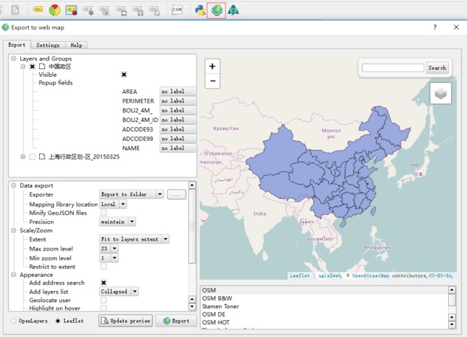
【Update perview】可以更换坐标系
【Export】导出即可
导出后会打开一个网页,我们需要的是data文件夹下的js,里面有geoJson数据
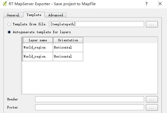
2.RT Mapfile Export
这是我们发布地图服务的重要的插件
使用插件的时候注意先设置好,打开Manager and Install Plugin对话框,注意在设置中勾选住实验性的插件一项,再搜索插件并进行安装。
2.发布服务
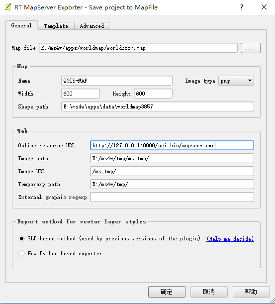
安装好RT Mapfile Export插件后,我们就可以使用QGIS导出Mapfile文件用来发布服务了。
坐标系
首先重要的一点是坐标系一定要选择好。如果不满足,可以使用QGIS工具Reproject Layer转换坐标系。目前常用的是EPSG:3857 墨卡托坐标系和EPSG:4326 WGS84坐标系,这里我们就以3857坐标系为例。
MapFile
在发布服务方面,MapServer有一个和mxd(ArcGIS)类似的map文件来描述地图的图层及样式,不同的是,在使用地图服务的时候,调用的url中需要知道map文件的位置,而ArcGIS则不需要
关于MapFile,这里就不单独介绍太多,Mapfile的作用如下图所示。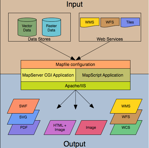
基本介绍:
http://blog.csdn.net/qingyafan/article/details/46500127
MapServer 快速入门文档:
http://live.osgeo.org/zh/quickstart/mapserver_quickstart.html
发布过程
因为我把发布的服务器端口改为8000了,所以Online resource url地址是http://127.0.0.1:8000/cgi-bin/mapserv.exe
1.
2.
3.
【确定】即可生成mapfile文件,在本文末尾会给出.
mapfile文件地址在E:\ms4w\apps\worldmap中。
我们在浏览器中输入地址http://127.0.0.1:8000/cgi-bin/mapserv.exe?MAP=E:/ms4w/apps/worldmap/world3857.map&LAYERS=World_region&MODE=MAP
注意:在使用类库调用该WMS服务的时候一定要去掉&MODE=MAP,否则不能成功。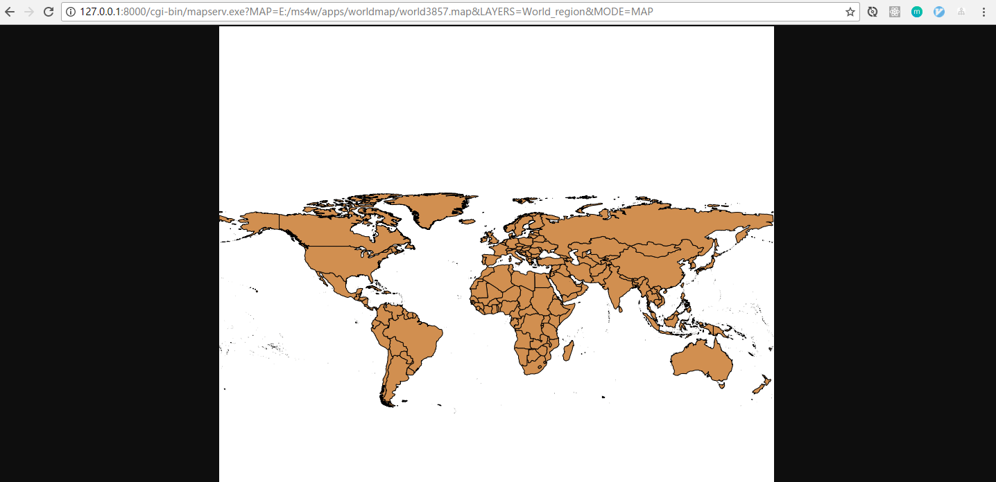
3.使用leaflet或openlayers调用
leaflet示例如下:1
2
3
4
5
6
7
8
9
10
11
12
13
14
15
16
17
18
19
20
21
22
23
24
25
26
27
28
29
30
31
32
33
34
35
36
37
38
<html lang="en">
<head>
<meta charset="UTF-8">
<title>leaflet加载MapServer示例子</title>
<!-- <link rel="stylesheet" href="../app/common/css/leaflet.css"> -->
<link rel="stylesheet" href="https://cdn.bootcss.com/leaflet/1.0.3/leaflet.css">
<style type="text/css">
#map {
width: 100%;
height: 600px;
}
</style>
</head>
<body>
<div id="map"></div>
<script src="https://cdn.bootcss.com/leaflet/1.0.3/leaflet-src.js"></script>
<!-- <script src="../app/common/leaflet-plugin/leaflet-src.js"></script> -->
<script type="text/javascript">
var map = L.map('map', {
crs: L.CRS.EPSG3857
});
map.setView([30, 104], 2);
// let map = L.map('map').setView([30, 104], 10); //默认墨卡托投影 ESPG:3857
//http://127.0.0.1:8000/cgi-bin/mapserv.exe?MAP=E:/ms4w/apps/test/test.map&LAYERS=ALL&MODE=MAP
//一定不要有&MODE=MAP
var myDemo = L.tileLayer.wms("http://127.0.0.1:8000/cgi-bin/mapserv.exe?MAP=E:/ms4w/apps/worldmap/world3857.map", {
layers: 'World_region',
format: 'image/png',
transparent: false,
crs: L.CRS.EPSG3857,
attribution: "自定义地图",
});
myDemo.addTo(map);
</script>
</body>
</html>
访问示例如下: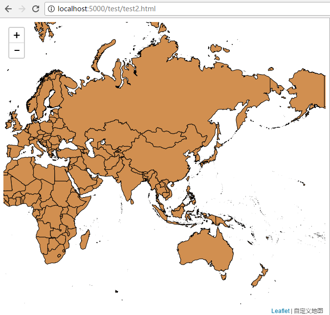
openlayers示例如下:1
2
3
4
5
6
7
8
9
10
11
12
13
14
15
16
17
18
19
20
21
22
23
24
25
26
27
28
29
30
31
32
33
34
35
36
37
38
39
40
41
42
43
44
45
46
47
<html lang="en">
<head>
<meta charset="UTF-8">
<title>openlayers 3加载MapServer示例子</title>
<link rel="stylesheet" href="https://openlayers.org/en/v4.1.1/css/ol.css" type="text/css">
<style type="text/css">
#map {
width: 100%;
height: 600px;
}
</style>
</head>
<body>
<div id="map"></div>
<script src="https://openlayers.org/en/v4.1.1/build/ol.js" type="text/javascript"></script>
<script type="text/javascript">
var layers = [
new ol.layer.Tile({
source: new ol.source.OSM()
}),
new ol.layer.Tile({
source: new ol.source.TileWMS({
url: 'http://127.0.0.1:8000/cgi-bin/mapserv.exe',
params: {
'layers': 'World_region',
'MAP': "E:/ms4w/apps/worldmap/world3857.map",
'TILED': true
},
serverType: 'mapserver',
})
})
];
var map = new ol.Map({
target: 'map',
layers: layers,
view: new ol.View({
center: ol.proj.fromLonLat([104, 30]),
zoom: 2,
projection: 'EPSG:3857'
})
});
</script>
</body>
</html>
访问示例如下: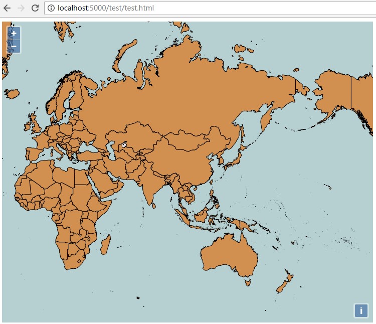
4.附录:mapfile文件world3857.map
1 | MAP |
所有配置和示例我都放在了github仓库中mapserver-leaflet-openlayers。